16.04.2019-22.04.2019
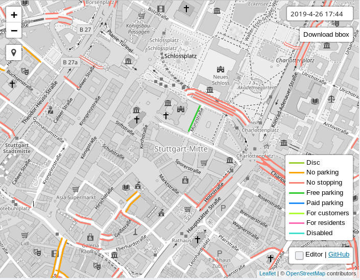
Anzeigen und Ändern der Kartierung von Parkmöglichkeiten am Straßenrand 1 | Leaflet | Map data © OpenStreetMap Mitwirkende
Mapping
- Andy Mabbett stellt die Frage, ob jede Niederlassung eines Konzerns oder Firmengruppe mit
wikidata=der Gesellschaft erfasst werden sollte oder ob – mit Ausnahme der Zentrale –brand:wikidata=oderfranchise:wikidatabessere Möglichkeiten bieten, die Zugehörigkeit zu markieren. - Dave F will wissen, ob mit
junction=yesgetaggte Polygone irgendwo verwendet werden. Gemäß den Antworten von Mateusz Konieczny und Tobias Knerr wird es ausgewertet. - Valor Naram hat ein Proposal für die Erfassung von Wickeltischen erstellt und bittet um Kommentare.
- Das Tagging-Proposal Police Facilities, das zusätzliche Detail-Tags für polizeiliche Einrichtungen einführen wollte, hat die nötige Mehrheit knapp verfehlt.
- Leif Rasmussen hat ein Proposal für eine bessere Erfassung von Informationen zur Verbindung von Fahrspuren erarbeitet, da er der Meinung ist, dass das aktuelle
turn:lanes=-Modell nicht für komplexe Kreuzungen geeignet ist. Simon Poole verweist auf einen ähnlichen Vorschlag für einentransit=-Tag von 2015, der aufgegeben wurde. - Joseph Eisenberg will Hochebenen mappen und fragt auf der Mailingliste Tagging nach einem geeigneten Tag-Value dafür nach. Andere sind der Meinung, dass Hochebenen und andere unpräzise definierte und schwer vor Ort überprüfbare Gebiete nicht ins Datenmodell von OSM passen, sondern anderswo gespeichert und Kartenstilautoren zugänglich gemacht werden sollten. Frederik Ramm meint dazu, man solle mit dem Feature-Wahnsinn aufhören.
Community
- Ilya Zverev gibt bekannt, dass die Nominierungsphase für die OpenStreetMap Awards 2019 begonnen hat.
- OpenStreetMap wird in diesem Jahr 15 Jahre alt und anscheinend ist erst eine Party geplant. Danke, Michael Reichert, für die Erinnerung.
- Die portugiesische OSM Community debattiert auf der Mailingliste Talk-pt, über die Kartierung eines neuen Krankenhauses auf Madeira. Wenn dieses Krankenhaus im Bau ist, wie soll es dann kartiert werden? Wenn der Bau fertig gestellt, aber noch nicht eröffnet ist, wie soll es abgebildet werden? Wenn das Krankenhaus fertig ist, aber ohne Lizenz (und damit illegal) arbeitet, wie soll es erfasst werden? Wer sollte die mögliche (I)legalität prüfen? Was soll der Mapper tun? Alles ignorieren, bis das Krankenhaus offiziell eröffnet ist? Das sind einige der Fragen, die von der portugiesischen Gemeinschaft diskutiert wurden.
 (automatische Übersetzung)
 - Michael Reichert schlägt ein OSM-Wikicamp vor, um alle Fragen rund um das OSM-Wiki zu diskutieren – und davon gibt es viele. Wie er in seinem Beitrag schreibt, besteht die Chance, dass OSMs lokales deutschsprachiges Chapter, der FOSSGIS e.V., die Unterkunft finanziert.
- Die Bereinigung unseres Wikis hat in letzter Zeit an Popularität gewonnen. Anscheinend finden selbst Seiten, die vor 7 Jahren als veraltet gelöscht wurden, noch heute Leser. Ilya Zverev kritisiert die Löschung einer Wiki-Seite über das Testen der API 0.6. Leider endete die folgende Diskussion über die Löschrichtlinie für Wikis mit einem semantischen Streit über den jüngsten Fortschritt der OSM-API, die Verwendung des Wortes „Vandalismus“ und die Existenz oder Nicht-Existenz von „Gatekeepern“ in OSM.
- Die API 0.6 wurde letzte Woche 10 Jahre alt: Sie ging am 21. April 2009 in Betrieb. Ilya Zverev erinnert (automatische Übersetzung) an die Geschichte der Umstellung von API 0.5 und erklärt, warum es nie eine Version 0.7 der API geben wird.
 (automatische
  (automatische
 Importe
- Grigori Rechistov bereitete den Import von Wäldern, Ackerland und anderen Arten von Bodenbedeckung in Schweden mit Daten der schwedischen Umweltschutzbehörde vor und dokumentierte seinen Plan im Wiki. Auf der Mailingliste Imports geäußerte Kritik wurde ignoriert.
OpenStreetMap Foundation
- Christoph Hormann hat entdeckt, dass die Vorstandssitzung der OSMF am 24. April einen nicht öffentlichen Tagesordnungspunkt über GlobalLogic enthält.
- Rory McCann fragt, ob GlobalLogic sich indirekt als schuldig bekennt, weil sie selbst die Mitgliedschaften ihrer Mitarbeiter kündigen.
Veranstaltungen
- Bis zum 15. Juni 2019 können sich Ausrichter für die State of the Map 2020 bewerben.
- Am 8. Mai findet in Salzburg ein humanitärer Mapathon im iDEAS:lab statt.
- Christine Karch und Denis Helfer planen im Mai wieder ein OSM Treffen in Straßburg. Es wird „europäisch“ gesprochen und das Treffen soll halbjährlich etabliert werden.
Karten
- Philip Pierdomenico stellte seine OpenStreetMap Coffee Map auf Twitter vor.
- Wie Mapillary in seinem Blog berichtet, haben die fünf US-Verkehrsministerien von Utah, Florida, Arizona, Connecticut und Vermont Bilder von 430.000 km Straßen zu Mapillary hochgeladen, wo sie automatisch verarbeitet wurden, um Verkehrszeichen und andere Merkmale zu erkennen.
- Die Neue Züricher Zeitung berichtet über Entstehung und Entwicklung der Wheelmap durch den Verein Sozialhelden und stellt deren Gründer Raúl Krauthausen vor.
Open-Data
- Owen Boswarva twitterte, dass die kanadische Provinz New Brunswick die Lidar-Abdeckung mit unter GeoNB Open Data Licence stehenden Daten, abgeschlossen habe.
- Uli Deiters gab die Freigabe von 350.000 Pollerpositionen durch die Stadt Berlin als Open Data auf Twitter bekannt. Er zeigt einige schöne Visualisierungen und stellt die Daten im Shapefile-Format auf Github zur Verfügung.
Programmierung
- yaugenka hatte sich in 2017 eine Funktion für iD gewünscht, um ein ganzes Landuse-Polygon von einem way per Tastendruck zu lösen. Quincy Morgan hat diese Funktion kürzlich implementiert und eine kurze Animation über die Funktionsweise zur Verfügung gestellt.
- Die hilfreiche Funktion PgAdmin4 Geometry Viewer wurde in PgAdmin4 ab v3.3 mit einem OpenStreetMap-Hintergrund hinzugefügt. Beim Testen von PostGIS-Skripten wechseln Programmierer einfach zwischen Daten- und Geometrie-Viewer und vermeiden so, zwecks Visualisierung Daten in andere Tools zu verschieben.
- jguthrie100 hat einen Pull-Request für den iD-Editor gestellt, der eine Validierungsregel ergänzt, die vor mehrfach auftauchenden Adressen warnt.
Releases
- MapRoulette ist jetzt in der Version 3.3 erschienen. Die neueste Version fügt ein brandneues Bewertungssystem hinzu. Sie können jede Aufgabe, die Sie lösen, als „Review wanted“ markieren. Mapper können sich freiwillig melden, um die gelösten Aufgaben anderer Mapper in MapRoulette zu überprüfen. Weitere neue Funktionen umfassen eine neue portugiesische Lokalisierung und Benachrichtigungen per E-Mail.
- Aktuelle Release Änderungen, herausgesucht von wambacher.
Kennst du schon …
- … die regionalen OSM-Mailinglisten in Deutschland, die der FOSSGIS e.V. betreibt?
- … das neue Qualitätstool „Osmoscope“ von Jochen Topf? Es zeigt überlagerte Nodes an, sowie nicht definierte oder vereinsamte Nodes und Ways.
- [1] … den Parking Lanes Viewer von Benutzer ascd, mit dem man das Mapping von Parkmöglichkeiten am Fahrbahnrand in OSM anschauen und ändern kann?
- … die passenden Tags für Sitzgelegenheiten in Geschäften, Restaurants und weiteren Einrichtungen mit Konsumierung von Speis und Trank? Hierfür gibt es die beiden Tags
indoor_seatingundoutdoor_seating. Für die Außengastronomiefläche gibt es das Tagleisure=outdoor_seating. An einigen Stellen ist sogar die Art der Bestuhlung erfasst:outdoor_seating:comfortoder die Art des Wetterschutzes und Beschattung:weather_protection.
OSM in der Presse
- Ein detaillierter Artikel der New York Times über das Feuer der Notre Dame Cathedral enthielt verschiedene Schemata, Bilder und eine auf OSM basierende Karte der Kathedrale.
Weitere Themen mit Geo-Bezug
- The Guardian berichtet über den Kampf eines Mannes aus Ilford, einem Londoner Stadtteil im Nordosten Londons, um die Postleitzahl E19, die die Zugehörigkeit zu London anzeigt. Er ist besorgt, dass die aktuellen Postleitzahlen IG1 – IG6 nicht immer als Londoner Postleitzahl anerkannt werden und als Teil von Essex falsch gelesen werden könnten. Sein Kampf dauert nun 15 Jahre.
- Mapbox kündigt die Veröffentlichung seines Vision SDKs während der Shanghai Automotive Show an. Das SDK ermöglicht es Entwicklern, Funktionen wie Augmented Reality Navigation und Spurführung, Live-Verkehrsalarme und viele andere in eigene Fahranwendungen einzubauen. Das SDK kombiniert auch verarbeitete Live-Daten von Sensoren und Kameras mit klassischen Kartendaten, zu sogenannten AI Maps.
- Kenneth Field und Max Roberts zeigen, dass schematische Karten ein Thema sind, zu dem hochemotionale Debatten in der Öffentlichkeit geführt werden können.
- Ein Blog-Post der Bill & Melinda Gates Foundation berichtet, wie die Erhebung von Daten in Entwicklungsländern auf lokaler Ebene mit GPS hilft, Malaria durch räumliche Analyse der Daten zu überwachen.
- Die National Geographic berichtet, dass aufgrund der Eisschmelze im Himalaya mehr Menschen von Sturzfluten bedroht werden als gedacht. Forscher haben auch OpenStreetMap-Daten in ihre Untersuchungen einbezogen.
- Die GIScience Research Group der Universität Heidelberg führt momentan eine Umfrage durch, um zu erheben, wie städtische Grünflächen genutzt werden. Die Daten werden für die Entwicklung einer WebApp benötigt, welche es ermöglichen soll, auf Nutzerwünschen basierend, eine geeignete Grünfläche zu finden. Die Entwicklung der WebApp wird vom Bundesministerium für Verkehr und digitale Infrastruktur finanziert und gemeinsam mit verschiedenen Projektpartnern entwickelt.
- Nico Belmonte, ehemaliger Leiter der Visualisierung bei Uber, ist als General Manager für Karten, Kartenservice und -design zu Mapbox gewechselt.
- Die URISA 2019 Caribbean GIS Conference lädt dazu ein, Workshop- und Präsentationsvorschläge für die vom 18. bis 21. November in Port of Spain, Trinidad, stattfindende Veranstaltung einzureichen.
Wochenvorschau
| Wo | Was | Wann | Land |
|---|---|---|---|
| Graz | Grazer Linuxtage 2019 | 2019-04-26-2019-04-27 |  |
| Rennes | Recensement des parcs et jardins | 2019-04-28 |  |
| Cayenne | Rencontre mensuelle | 2019-04-30 | |
| Hochschule-Mannheim | Mannheimer Mapathons | 2019-05-02 |  |
| Bochum | Mappertreffen | 2019-05-02 | |
| Nantes | Réunion mensuelle | 2019-05-02 | |
| Zittau | OSM-Stammtisch Zittau | 2019-05-03 | |
| Essen | Mappertreffen | 2019-05-07 | |
| München | Münchner Stammtisch | 2019-05-08 | |
| Salzburg | Maptime Salzburg – Mapathon | 2019-05-08 | |
| Wuppertal | Wuppertaler Stammtisch im Hutmacher 18 Uhr | 2019-05-08 | |
| Berlin | 131. Berlin-Brandenburg Stammtisch | 2019-05-09 | |
| Rennes | Réunion mensuelle | 2019-05-13 | |
| Bordeaux | Réunion mensuelle | 2019-05-13 | |
| Lyon | Rencontre mensuelle pour tous | 2019-05-14 | |
| Hamburg | Hamburger Mappertreffen | 2019-05-14 | |
| Toulouse | Rencontre mensuelle | 2019-05-15 | |
| Karlsruhe | Stammtisch | 2019-05-15 | |
| Montpellier | State of the Map France 2019 | 2019-06-14-2019-06-16 | |
| Heidelberg | Erasmus+ EuYoutH_OSM Meeting | 2019-09-18-2019-09-23 | |
| Heidelberg | HOT Summit 2019 | 2019-09-19-2019-09-20 | |
| Heidelberg | State of the Map 2019 (international conference) | 2019-09-21-2019-09-23 | |
Hinweis:
Wer seinen Termin hier in der Liste sehen möchte, trage ihn in den Kalender ein. Nur Termine, die dort stehen, werden in die Wochennotiz übernommen. Bitte prüfe die Veranstaltung in unserem öffentlichen Kalendertool und korrigiere bitte die Einträge im Kalender, wenn notwendig.
Diese Wochennotiz wurde erstellt von Map-Peter, Nakaner, Rainero, Rogehm, SK53, SunCobalt, derFred, geologist.